How Do Sailors Know Where They Are At Sea?
Sailing is the art of navigating a vessel through the water using wind, tides and currents. To do so, sailors must be able to determine their exact position in the ocean, which is a skill that has been mastered over centuries of exploration and discovery.
In this article, we will discuss some of the methods used by sailors to find their way at sea, from the age-old technique of celestial navigation to modern GPS technology and beyond.
History of Navigation at Sea
Navigation at sea has been around since ancient times, people have been travelling across oceans for centuries in search of new lands, resources or trade routes. The first navigators used observations from stars, sun and moon as well as landmarks on shore to determine their location in relation to land masses or other vessels in the vicinity.
Early navigators also developed instruments such as compasses and sextants for aiding in navigation at sea, these tools are still used today by mariners who want to maintain traditional navigation techniques without relying on modern technology such as GPS systems or radar devices.
Celestial Navigation
Celestial navigation is one of the oldest methods used by sailors to determine their position at sea and is based on observations made from celestial bodies such as stars, planets and the sun or moon.
By noting the positions of these bodies relative to each other in relation to the horizon, a sailor can calculate his latitude (north-south) coordinates as well as his longitude (east-west) coordinates with great accuracy when combined with other navigational tools such as a sextant or compass.
Dead Reckoning
Dead reckoning is another traditional method for determining one’s position at sea that does not rely on celestial observations but rather estimations based on course direction, speed travelled and time elapsed since last known coordinates were determined.
This technique has been widely used throughout history by mariners who needed a quick way to estimate their location without having access to more advanced navigational aids such as GPS systems or radars, however, it can be inaccurate if not supplemented with other navigational techniques or instruments due to its reliance on estimations rather than actual measurements from fixed points in space like those provided by celestial bodies or landmarks ashore.
Modern Navigation Systems
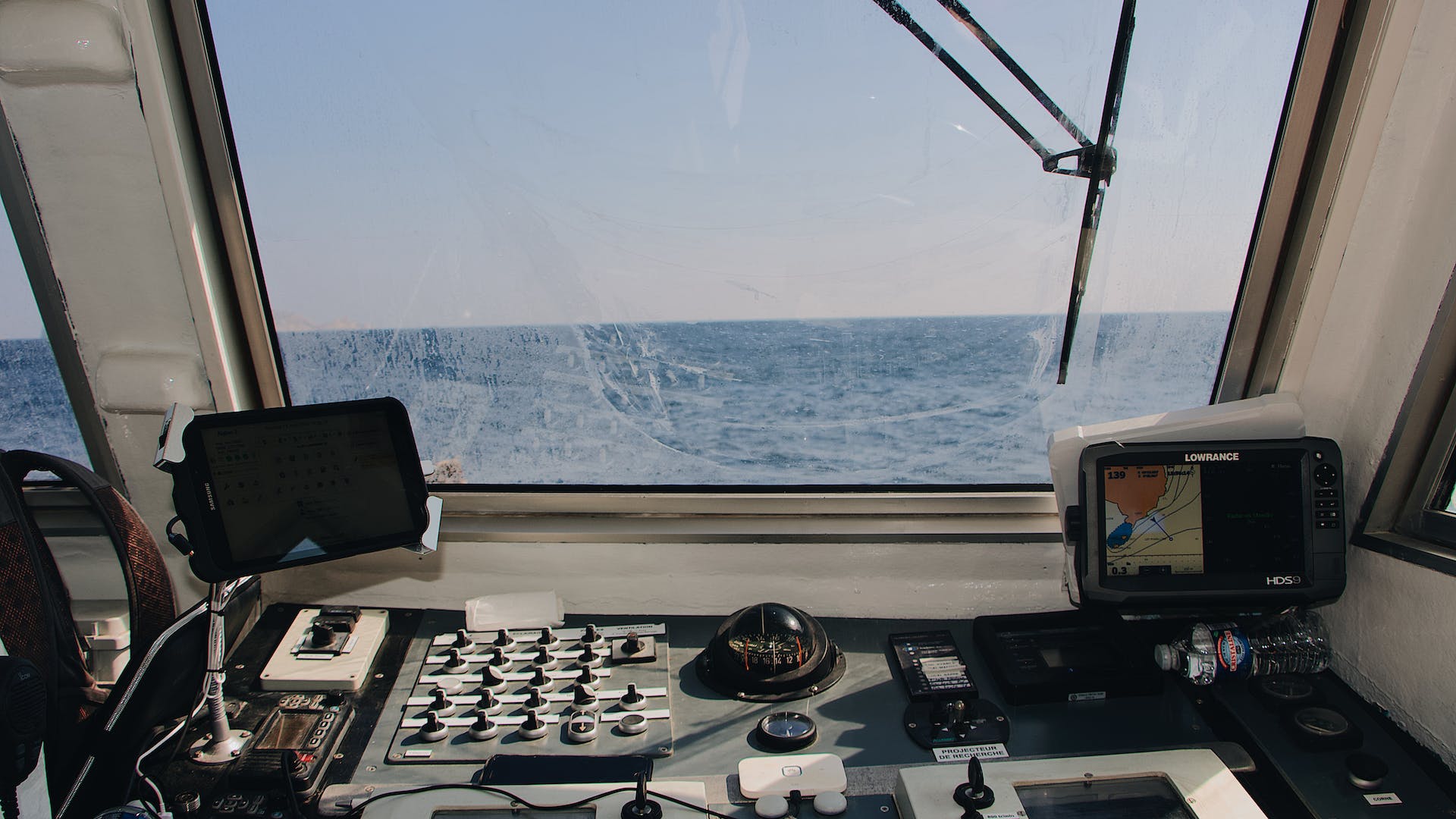
Modern navigation systems make use of various technologies such as GPS (Global Positioning System), radar devices, radio beacons and even satellites for determining one’s exact location in relation to land masses or other vessels in the area with greater accuracy than was ever possible before with traditional methods such as dead reckoning or celestial navigation alone, however, these systems can be affected by interference caused by weather conditions or other factors so it is still important for mariners to know how to use traditional methods alongside modern technologies for maximum accuracy when determining one’s position out at sea.
Nautical Charts & Compasses
Nautical charts are maps specifically designed for navigation purposes which provide mariners with detailed information about water depths, land contours, currents and even potential hazards that could be encountered during a voyage, they are essential for any sailor who wants to plot an accurate course through unfamiliar waters or avoid dangerous obstacles along the way.
Compasses are also an invaluable tool for navigating both close-to-shore waters as well as open seas, they help sailors determine direction relative to magnetic north which allows them more control when plotting courses through various terrain types like reefs or shallows where other navigational instruments may not be useful due to limited visibility conditions present in these areas .
Using a Sextant
A sextant is an instrument used mainly for celestial navigation that helps mariners measure angles between two visible objects (such as stars) relative to each other above the horizon line, this information can then be used together with nautical charts and compasses for plotting out an accurate course over long distances across open seas where other navigational aids may not be available due to lack of visibility or interference from weather conditions present during voyages across different regions .
Global Positioning System (GPS)
The GPS system makes use of satellites orbiting Earth which allow mariners pinpoint their exact location anywhere on its surface with great accuracy, this technology has revolutionized modern navigation by providing sailors with a safe way of plotting courses through unfamiliar waters without relying solely on traditional methods which could potentially lead them off course due incorrect estimations due weather conditions interfering with observations taken from stars overhead .
Radar & Radio Navigation Aids
Radar systems allow sailors detect objects around them using reflected waves emitted from antennas placed aboard vessels, this technology can help detect obstacles like rocks jutting out of water surfaces which would otherwise remain undetected due limited visibility conditions present during certain weather events like foggy nights when visibility drops significantly .
Radio navigation aids also provide assistance during voyages out into deep ocean waters by allowing ship captains receive transmission signals coming from beacons located ashore which provide information about distances between shore stations relative ships’ locations .
Other Navigational Tools & Techniques
Apart from those already mentioned above, there are several additional techniques that have been developed throughout history for helping mariners plot courses accurately even when navigating through unfamiliar waters, these include techniques like keeping track of tidal movements along coasts – which helps facilitate calculations related current speeds -as well as observing animal behaviors near shorelines -which can help indicate presence potential land masses nearby.
However, many of these techniques require experience combined knowledge which only comes after years spent sailing out into oceans around world so they’re usually only applicable experienced captains rather than amateurs just starting out on their journeys into unknowns seas
Conclusion: Summary Of How Sailors Know Their Position At Sea
Sailors have been navigating oceans since ancient times thanks advances made throughout centuries related technologies developed specifically for aiding them finding their way across vast expanses watery terrain .
From traditional techniques like dead reckoning , celestial observation , nautical charts compasses , modern technologies like GPS , radar radio devices , there’s no shortage methods available today’s mariner ensuring safe efficient passage any voyage they undertake regardless destination they seek reach .


